
RTK vs LiDAR Robot Mower: Which Navigation Fits Your Lawn?
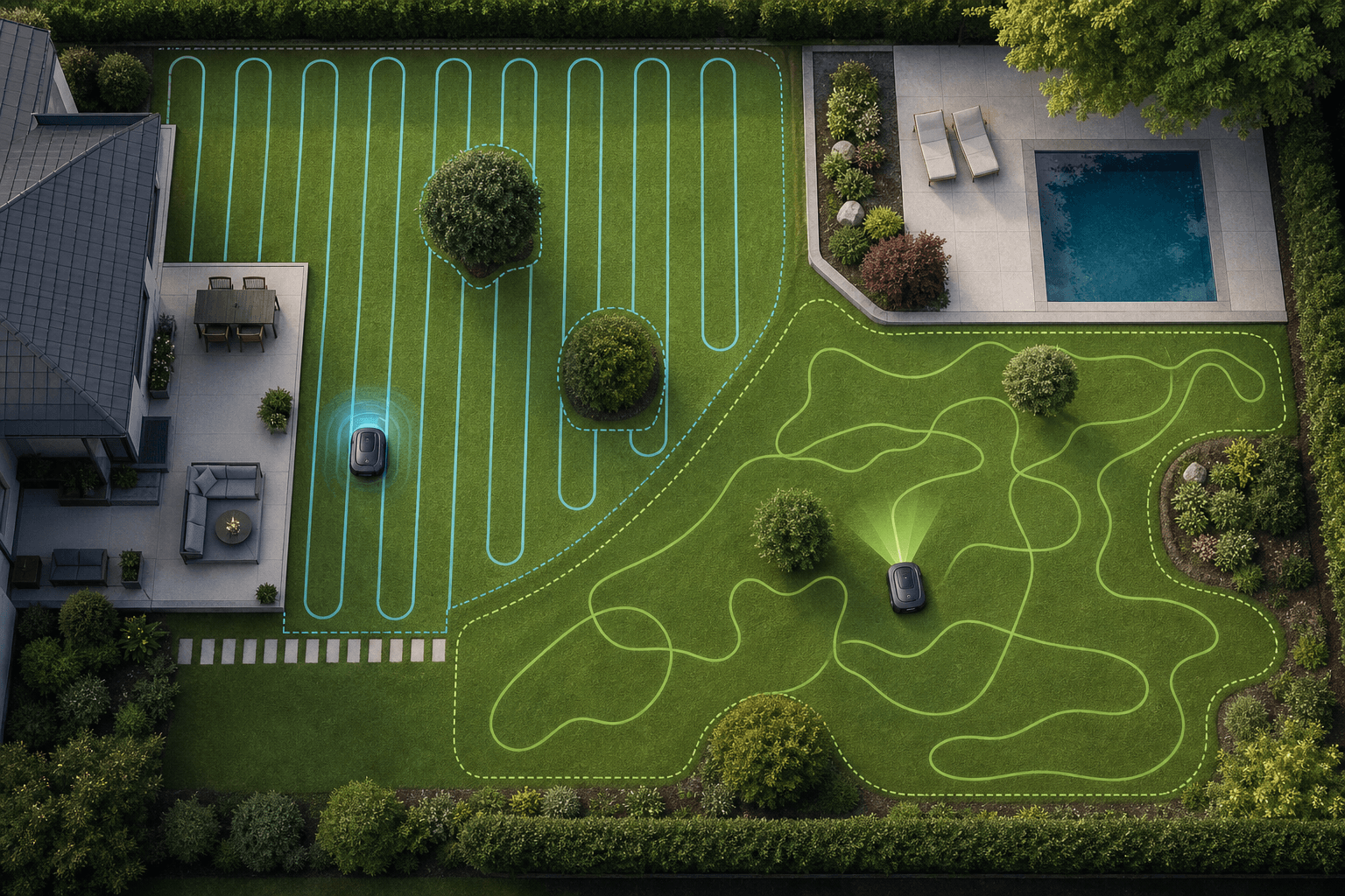
RTK and LiDAR solve wire-free navigation in different ways. RTK uses corrected satellite positioning to place the mower accurately on a map, while LiDAR measures the mower’s immediate surroundings. The better fit depends less on the technology label than on your sky visibility, obstacles, lawn layout and tolerance for additional hardware.

RTK vs LiDAR Robot Mower: Which Navigation Fits Your Lawn?
Choose RTK when the lawn has a reasonably open view of the sky and you want consistent map-based navigation across clear, connected areas.
Choose LiDAR when buildings, trees or other obstructions make satellite reception less dependable, or when local obstacle awareness is a priority.
Neither technology is automatically better. Hybrid systems can combine satellite positioning, LiDAR and vision so that one sensor can support another when conditions change.
RTK and LiDAR are not always alternatives
Modern wire-free mowers may combine RTK, LiDAR, cameras, inertial sensors and wheel-position data. RTK can provide a global position on the lawn, while LiDAR and vision interpret the immediate environment. This can make hybrid navigation more resilient than relying on one input alone.
A longer sensor list is not automatically the right choice. On a simple, open lawn, a well-implemented RTK system may be sufficient. In an enclosed garden with reliable physical landmarks, LiDAR-based localization may avoid the complexity of reference-station placement. A simpler mower may also be enough if the lawn has one clear area and few obstacles.
If wire-free navigation itself is still the main decision, compare it with a conventional installation in our boundary wire versus wire-free guide.
Judge the weakest signal areas, not the easiest lawn
A broad central lawn can make almost any navigation system look suitable. The more useful test is what happens beside the house, beneath trees, along fences and through passages connecting zones.
For RTK, look upward: consider how much of the sky is obscured and whether a base station, if required, can be installed in a suitable position. For LiDAR, look outward: consider whether the mower will have stable structures and features to map, and whether vegetation changes substantially through the season.
Also trace how the mower reaches each mowing area. Navigation technology does not create a usable route through steps, closed gates or unsuitable surfaces. Some models can follow transport paths; others may need to be carried between disconnected zones. For a wider suitability check, see whether your lawn suits a robot mower.
What matters most
Use the lawn’s physical conditions to narrow the choice before comparing apps or convenience features.
Open lawn with clear sky
RTK is often the more direct fit. It provides map-based positioning without needing the garden to contain many nearby visual or geometric landmarks.
Trees, walls or tall buildings
LiDAR deserves closer consideration because it can localize from nearby surroundings. A hybrid system may offer additional resilience where signal conditions vary across the lawn.
Many small obstacles
Prioritize the complete obstacle-detection system, not LiDAR alone. Cameras, sensor placement and object-recognition software affect whether the mower can respond to low or unusual items.
Disconnected mowing zones
Check zone limits and transfer behavior separately. RTK or LiDAR may map multiple areas, but the mower still needs a practical way to move between them.
Models worth considering
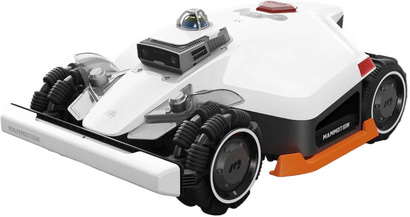
Mammotion LUBA 3 AWD 1500
An all-wheel-drive mower using LiDAR and vision, with no physical RTK installation for this variant.
Best for: Difficult terrain where strong traction and obstruction-tolerant local navigation are more relevant than RTK positioning.
Consider: Its navigation approach differs from the related larger variant, so do not assume RTK support is shared across the range.

Mammotion LUBA 3 AWD 3000
A hybrid all-wheel-drive model combining LiDAR, vision and network RTK without requiring a physical base station.
Best for: Larger, complex lawns that benefit from high traction and several complementary navigation inputs.
Consider: Hybrid navigation does not remove the need to check transport paths, connectivity and terrain across every mowing zone.
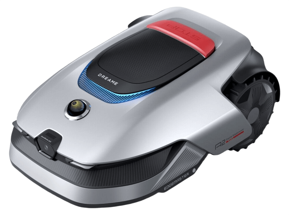
Dreame A2
A LiDAR-and-vision mower designed for systematic mowing and strong obstacle recognition without RTK.
Best for: Complex or signal-obstructed gardens where local mapping and object awareness take priority.
Consider: Separated areas may require manual carrying, so assess access between lawn sections before focusing on navigation performance.
FAQ
Is LiDAR more accurate than RTK for robot mowers?
Not in every setting. RTK can provide precise global positioning when satellite reception and correction data are dependable. LiDAR can be more resilient near structures or tree cover because it reads local surroundings. Implementation and lawn conditions matter more than a universal accuracy ranking.
Does an RTK robot mower always need a base station?
No. Some systems use a physical reference station, while others can receive correction data through a network. The requirement is model-specific.
Can LiDAR work under trees?
LiDAR does not require satellite visibility, so tree cover is not the same fundamental limitation it can be for RTK. Dense vegetation, changing foliage and weak local map features may still affect localization.
Does LiDAR replace obstacle avoidance cameras?
Not necessarily. LiDAR measures shapes and distances, while cameras and recognition software may help classify objects. Systems that combine sensors can use each for a different role.
Which is better for a small, simple lawn?
Either may work, but the simplest suitable system is usually the sensible choice. If the lawn is open and uncomplicated, advanced hybrid navigation may add little practical value. A boundary-wire mower may also remain relevant if installation is acceptable.
Can RTK and LiDAR mowers cross paths between lawn zones?
That depends on the model and the route, not simply on RTK or LiDAR. Check whether transport paths are supported and whether gates, steps and non-grass surfaces are passable.
Choose for the places where navigation is hardest
Start with sky visibility, nearby structures, tree cover and routes between zones. Then compare terrain capability and obstacle handling. If you want to narrow compatible models from the full lawn profile, use the MowCompass mower finder.
Find a mower for your lawn